The secretary of the Air Force for international affairs recently approved the Air Force Directorate Of Weather's request to release previously restricted weather data and software programs to many U.S. allies and coalition partners.
This sharing of technology and information forges a new path in the international arena, weather officials said.
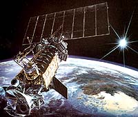
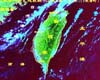
As the Defense Department center of excellence for weather satellite imagery, the Air Force Directorate Of Weather manages weather satellite data received from the defense meteorological satellite program.
This high-resolution DMSP capability has been coveted since its inception in 1965 because it saves surveillance and observation time when targets are obscured by clouds, said Lt. Col. Brian Bjornson, deputy chief of policy for the Air Force Directorate of Weather.
Many U.S. allies now have permanent access to this real-time DMSP data, a huge leap forward from their current technologies, Bjornson said. Coalition partners will also have access, but on a controlled and more limited basis.
Also, night vision goggle operational weather software is now releasable to all allies who purchased goggles from the United States. Allies who purchased weapons systems from the United States may also have access to target acquisition weather software.
Both software packages have been the most requested weather-related computer programs for the past decade because of their unique application to electro-optical munitions delivery operations, Bjornson said.
"The tools are so popular that the Navy, in partnership with the Air Force Research Lab, is funding modifications that will enable use on defense information infrastructure and common operating environment compliant systems," Bjornson said.
"Military operators have learned from past experience that they can be much more effective with precision weapons if they incorporate precision weather forecasting tools in their planning and execution process," he said.