All the three cameras on board ISRO's latest remote sensing satellite, ResourceSat-1, have been tested and the photographs received indicate excellent performance of the cameras. ResourceSat-1, which was launched by ISRO's Polar Satellite Launch Vehicle, PSLV-C5, from Satish Dhawan Space Centre-SHAR on October 17, 2003.
- ResourceSat-1 carries three cameras on board:
- A multi-spectral high spatial resolution camera, namely, Linear Imaging Self Scanner-4 (LISS-4) providing a spatial resolution of 5.8 m and a swath of 23 km. It operates in the Visible and Near Infra Red spectral bands. LISS-4 can also be operated in mono-chromatic (black and white) mode providing a spatial resolution of 5.8 m and a swath of 70 km. Besides, the camera can be steered across track to take stereoscopic imagery.
- A multi-spectral Linear Imaging Self Scanner-3 (LISS-3), which has a spatial resolution of 23 m and a swath of 141 km. It operates in the Visible, Near Infra Red and Short Wave Infra Red spectral bands.
- A multi-spectral Advanced Wide Field Sensor (AWiFS) with a spatial resolution of 56 m providing a swath of 740 km. The camera operates in the Visible, Near Infra Red and Short Wave Infra Red spectral bands. AWiFS is a unique camera having the capability to take the imagery of the world repeatedly every 5 days with a very high radiometric resolution.
With the unique combination of cameras providing imageries with high spatial, spectral, temporal and radiometric resolutions, ResourceSat-1 is expected to enhance the remote sensing applications, especially, in the fields of agriculture, land and water resources management, and, disaster management.
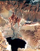
The cameras were tested for their performance during October 25-November 5, 2003. The sample photographs have been generated from the data acquired from ResourceSat-1 and processed at National Remote Sensing Agency, Hyderabad.
 Envisat Radar Altimetry Tracks River Levels Worldwide
 Paris - Nov 12, 2003
