| . |  |
. |
DigitalGlobe has announced that RMTC/URS, along with Kauai County and the State of Hawaii, has purchased high-resolution DigitalGlobe's QuickBird satellite imagery for more effective digital mapping in Hawaii. RMTC/URS is a joint venture of R.M. Towill, URS, Dewberry, TerraPoint, Airborne1, and Sea Engineering, and provides flood hazard engineering and mapping services to the U.S. Department of Homeland Security's Federal Emergency Management Agency (FEMA). DigitalGlobe's imagery of Kauai County and the infamously rainy Waimea Canyon will allow local, state and federal entities to more effectively pursue flood plain mapping projects and disaster mitigation initiatives. According to Stephanie Routh at joint venture partner Dewberry, "Two-foot pixel resolution satellite imagery that meets FEMA base map specifications for accuracy and distributability for Digital Floodplain Insurance Rate Mapping (DFIRM) is a great tool. "DigitalGlobe's satellite imagery gives local, state and federal agencies access to much-needed data over regions of Hawaii that historically have been challenged by terrain and topography, and allows us to make a better DFIRM product for the communities." DigitalGlobe delivered to RMTC/URS a Digital Ortho Quarter Quad (DG DOQQ) product. Comprised of QuickBird satellite imagery, the DG DOQQ provides the best quality imagery at the highest resolution, making it an up-to-date tool for regional mapping projects, especially in more remote areas such as the Pacific Islands. The DG DOQQ offers a two-foot resolution, georeferenced, seamless digital image mosaic. The solution is ideal for government and commercial customer applications, including geographic information system (GIS) updates, map creation and revision, emergency management, and natural resource management. Many mapping experts traditionally rely on U.S. Geological Survey (USGS) DOQQs for their imagery needs. The DG DOQQ differs from the USGS DOQQ in that it has a higher resolution, more image options and multiple projection options. In this case, RMTC/URS, Kauai County, and the State of Hawaii shared the cost to purchase the four-band multispectral, pan-sharpened imagery. This DOQQ includes coverage of the entire island of Kauai, as well as a buffer around the island that illustrates bathymetric data, coral reef mapping and other features. The product allows Kauai County to now begin a full GIS program that will benefit local, state and federal agencies alike. According to Ray Lenaburg, senior engineer at FEMA Region IX, "The absence of distributable, available imagery has been a hindrance in flood mapping projects in this area in the past. DigitalGlobe's imagery is a great utility. We were very excited to learn that Kauai County and the state of Hawaii were interested in sharing the cost to purchase this quality product for mapping needs. "We look forward to using more DigitalGlobe products for DFIRM projects for the Hawaiian Islands and other U.S. territories in the Pacific." Related Links DigitalGlobe TerraDaily Search TerraDaily Subscribe To TerraDaily Express 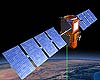 Paris (SPX) May 20, 2005
The climatology satellite Calipso (Cloud-Aerosol Lidar and Infrared Pathfinder Satellite Observations) left Alcatel Space, a subsidiary of Alcatel, plant in Cannes (southern France) during the night of May 18 for transport to the Vandenberg Air Force Base and spaceport in California. |
|
| The content herein, unless otherwise known to be public domain, are Copyright 1995-2016 - Space Media Network. All websites are published in Australia and are solely subject to Australian law and governed by Fair Use principals for news reporting and research purposes. AFP, UPI and IANS news wire stories are copyright Agence France-Presse, United Press International and Indo-Asia News Service. ESA news reports are copyright European Space Agency. All NASA sourced material is public domain. Additional copyrights may apply in whole or part to other bona fide parties. Advertising does not imply endorsement, agreement or approval of any opinions, statements or information provided by Space Media Network on any Web page published or hosted by Space Media Network. Privacy Statement All images and articles appearing on Space Media Network have been edited or digitally altered in some way. Any requests to remove copyright material will be acted upon in a timely and appropriate manner. Any attempt to extort money from Space Media Network will be ignored and reported to Australian Law Enforcement Agencies as a potential case of financial fraud involving the use of a telephonic carriage device or postal service. |