| . |  |
. |
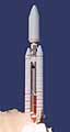
Dulles - January 13, 1999 - OrbImage will acquire the worldwide sales and distribution rights for the advanced radar imagery to be provided by the RadarSat-2 satellite. The RadarSat-2 satellite system is being designed and constructed by Orbital's MacDonald, Dettwiler and Associates Ltd. (MDA) subsidiary, based in British Columbia, Canada, under a contract recently signed with the Canadian Space Agency. The contract with CSA includes an initial pre-launch radar imagery purchase commitment valued at $140 million. The 1,650 kilogram RadarSat-2 satellite incorporates state-of-the-art technology that will provide the most advanced commercially available satellite radar imagery in the world. RadarSat-2 will image the entire Earth in a polar, sun-synchronous orbit at an altitude of 800 kilometers. It will be capable of ground imaging at spatial resolutions ranging from 3 to 100 meters with swath widths ranging from 20 to 500 kilometers. RadarSat-2 is also the first commercial satellite to offer multi-polarization imaging capability that aids in identifying a wide variety of surface features and targets. It is scheduled for launch in late 2001 and is expected to operate until at least 2008. RadarSat-2 will provide OrbImage with the ability to acquire imagery at night and through clouds. With up to 75% of the Earth's surface covered by either darkness or clouds at any given time, its space-based radar imagery should double the effective imagery capacity of the OrbImage constellation of satellites. The advanced imagery products generated by RadarSat-2 are expected to be of interest to users in a wide variety of market applications ranging from land mapping, petroleum, geology and transportation planning to scientific research, environmental monitoring and national defense. Under the OrbImage arrangement with MDA, the collection, processing and marketing of RadarSat-2 imagery will be carried out in Canada. "This is the latest in a series of significant events that have advanced OrbImage to a clear leadership position in the satellite remote sensing market," said Mr. Gilbert D. Rye, OrbImage's President and Chief Operating Officer. "When combined with the imagery available from OrbImage's basic constellation of four optical imaging satellites -- OrbView-1 and OrbView-2, which are already in operation, along with OrbView-3 and OrbView-4, planned for this year and next year -- the Canadian RadarSat-2 satellite will allow us to offer synthetic radar images of the Earth's land areas and oceans in daytime, at night and under cloudy or hazy conditions. No other satellite imagery company in the world can offer such a wide array of advanced services," he added. An affiliate of Orbital Sciences Corporation, OrbImage is a leading global provider of satellite-delivered Earth imagery services with a constellation of four digital remote sensing satellites. It currently operates the OrbView-1 atmospheric imaging satellite that was launched in 1995, the OrbView-2 ocean and land multi-spectral imaging satellite launched in 1997 and an integrated image receiving, processing and distribution system with 14 active regional ground stations around the world. OrbImage also plans to launch the OrbView-3 high-resolution optical imaging satellite later this year and the companion OrbView-4 high-resolution/hyperspectral imaging satellite next year.
RadarSat Reports At SpaceDaily
OrbImage Reports At SpaceDaily
Other Earth Observation Reports At SpaceDaily
 Lake Forest Ca - January 13, 1999 -
 iBASEt a leading provider of paperless manufacturing execution systems (pMES), has signed a contract with Alliant Techsystems for its Shopfloor 2000 software, integration and training services to build expendable launch vehicle components at Alliant's Iuka, Miss., plant. |
|
|
|
|
|
|
|
|
|
|
|
|
|
| The content herein, unless otherwise known to be public domain, are Copyright 1995-2006 - SpaceDaily.AFP and UPI Wire Stories are copyright Agence France-Presse and United Press International. ESA PortalReports are copyright European Space Agency. All NASA sourced material is public domain. Additionalcopyrights may apply in whole or part to other bona fide parties. Advertising does not imply endorsement,agreement or approval of any opinions, statements or information provided by SpaceDaily on any Web page published or hosted by SpaceDaily. Privacy Statement |
