| . |  |
. |
Fayetteville AK (SPX) Dec 27, 2006 Researchers at the University of Arkansas and Purdue University have monitored tiny tectonic movements in the Caribbean to create the first comprehensive and quantitative kinematic model describing potential earthquake activity in the region. University of Arkansas researchers Pamela Jansma and Glen Mattioli, together with Purdue University researchers D. Manaker and Eric Calais, presented their findings at the fall meeting of the American Geophysical Union. Several large earthquakes have struck the Caribbean region in the past 500 years in the vicinity of Puerto Rico, the U.S. Virgin Islands and the island of Hispaniola, shared by Haiti and the Dominican Republic. Millions of residents live in the Caribbean Islands, so a better understanding of the likely location of earthquakes could help people better prepare for the possibility. For the past 12 years, Jansma and Mattioli have used global positioning satellite geodesy to monitor very small movements along the tectonic plates in the Caribbean basin to determine the relative motion between the Caribbean and the North American plates. Caribbean plate boundaries are interesting because the plates move extremely slowly - about 2 centimeters a year - making the region an important part of the global picture of how plates interact. "We have to wait a long time to see results with the GPS," Jansma said. After 12 years of gathering data, the researchers felt they had enough information to build a preliminary model. In doing so, they try to build a model that explains the movement along the plate interface to see if there is sticking going on between the two plates. "If the plates are stuck and not moving past each other smoothly, at some time they will break, and if they break, it will release a lot of energy" in the form of an earthquake, Mattioli said. The model contains data on the slip rates of the main faults and strain accumulation at various sites, based both on GPS sites and geological evidence. It also includes information on the locked zone of the faults - the depth on the fault that is partially stuck-- and the location of known fault boundaries. The researchers found that coupling, or sticking, was low in Puerto Rico and the Virgin Islands, but was much higher in the Dominican Republic, Haiti and Hispaniola, which implies an elevated risk of earthquakes in that region. "This result isn't surprising if you look at the geomorphology of the region," Jansma said. The Dominican Republic is more mountainous than Puerto Rico, implying more deformation. The next step will be to refine the model using more data gathered from the region over time. "Regional models like these show you where the important data holes are. They make predictions about where you should put additional sites," Jansma said. The next version of the model will include new data collected in 2006 and 2007 and should be better still. Mattioli and Jansma are professors of geosciences in the J. William Fulbright College of Arts and Sciences. Related Links University of Arkansas, Fayetteville When the Earth Quakes 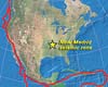 Lexington KY (SPX) Dec 20, 2006
Drilling has been completed on the deepest borehole for seismic instruments in the eastern U.S. The four-inch diameter hole for the Central U.S. Seismic Observatory (CUSSO), located at Sassafras Ridge in Fulton County, Kentucky, reached a depth of 1,948 feet, where bedrock was encountered. |
|
| The content herein, unless otherwise known to be public domain, are Copyright 1995-2006 - SpaceDaily.AFP and UPI Wire Stories are copyright Agence France-Presse and United Press International. ESA PortalReports are copyright European Space Agency. All NASA sourced material is public domain. Additionalcopyrights may apply in whole or part to other bona fide parties. Advertising does not imply endorsement,agreement or approval of any opinions, statements or information provided by SpaceDaily on any Web page published or hosted by SpaceDaily. Privacy Statement |
