| . |  |
. |
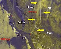
Washington DC (SPX) Jan 05, 2007 The 2006 wildfire season in the United States set an all-time record with more than 9.8 million acres burned in more than 96,000 wildfires. NOAA satellites were key in detecting and monitoring the movement of the blazes, providing invaluable information to firefighters on the ground. Throughout the season, NOAA's two geostationary satellites and two polar-orbiting spacecraft provided more than 200 images each day. The most hectic stretch of last year's season came between July and September, when NOAA satellites detected 98,848 hot spots. "Satellite detection of fires and hotspots provides valuable information about the location of emerging fire problems," said Heath Hockenberry, the NOAA National Fire Weather Program leader, located at the National Interagency Fire Center in Boise, Idaho. "This information allows on-site fire weather forecasters to remain aware of new fire locations and potential problem areas." Along with satellite coverage, part of NOAA's operational fire and smoke program includes the Hazard Mapping System, which detects the wildfires and tracks the smoke they produce. HMS, which incorporates both NOAA and NASA satellites, tracks smoke from wildfires occurring throughout all of North America and pinpoints fires that are emitting the most smoke. HMS overlays fire locations with satellite imagery, providing analysts on the ground a high measure of quality control. "NOAA Incident Meteorologists and fire weather forecasters always need to know where fires are and how they are developing in complex terrain," Hockenberry said. "This information is essential to on-site fire weather forecast accuracy and usefulness." "The smoke from these fires can be extremely harmful to air quality, which is a threat to health and public safety," said Mary E. Kicza, assistant administrator for the NOAA Satellite and Information Service. "NOAA is committed to providing the satellite coverage and products needed to help save lives and property from dangerous fires." Related Links NOAA National Fire Weather Program NOAA Fire Weather Information Center NOAA Fire Events Satellite Imagery NOAA Satellites Portal  Hong Kong (AFP) Jan 02, 2007
Hong Kong telecom authorities assumed emergency powers Tuesday as firms faced Internet disruption on the first day back to work after an earthquake damaged regional undersea data cables. Telecom and Internet service providers sent the city's telecom authority OFTA hourly updates on service capacity as repair ships struggled to mend fibre optic cables severed in the Boxing Day quake off Taiwan. |
|
| The content herein, unless otherwise known to be public domain, are Copyright 1995-2006 - SpaceDaily.AFP and UPI Wire Stories are copyright Agence France-Presse and United Press International. ESA PortalReports are copyright European Space Agency. All NASA sourced material is public domain. Additionalcopyrights may apply in whole or part to other bona fide parties. Advertising does not imply endorsement,agreement or approval of any opinions, statements or information provided by SpaceDaily on any Web page published or hosted by SpaceDaily. Privacy Statement |